TRIMINGHAM BEACH Revisited 2025
The beach visits began in 2019 and it was originally planed that a look at the cliffs and the beach every few years would record any significant changes, however it is now become an annual thing and clearly shows the rapid changes that are taking place. The sea defences are now reaching the end of their useful life and with no prospect of any maintenance or renewal the erosion of the cliff base is likely to increase and along with increased amounts of ground and surface water causing cliff falls the prospect of loosing more and more land and property is a stark reality!
This year one small difference I have made the walk from west to east beginning at the old marker buoy.
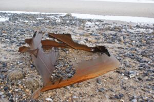
The old marker buoy has remained in this position ever since it washed up here over 30 years ago, it has moved a little further down the beach from previous years but has now corroded through and has filled with sand and shingle.
The sea defences start at around 400 MTS east from this point and the undefended cliff face continues to creep back from the end of the revetment. The cliff base was in line with the structure when it was completed in the 1970`s and the amount of cliff loss can clearly be seen in the next photo.
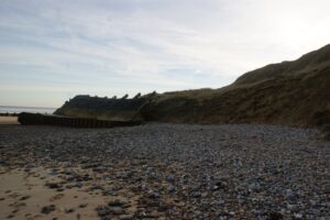
No steps here this year, they have been washed away!
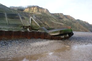
The end of the revetment and this point takes the full force of any tidal surge and it slowly continues to break up. The opening in the revetment corner was a once planned beach access point with a concrete ramp.
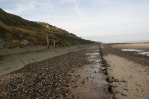
Looking back along the defences and the last 150 MTS of timber revetment and concrete remain intact, but the next part of the defences have now really deteriorated.
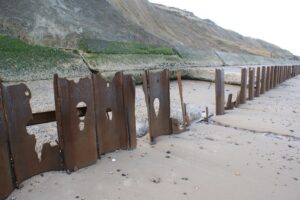
The timber revetments have all gone here and each high tide gets over the wall and washes away the beach right up to the cliff base. This has allowed the concrete to become undermined and in many places this is now collapsing.

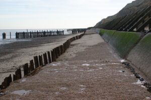
Two more views of the collapsing concrete.
The flat concrete section also once had a “kerb” piece at the metal edge which retained beach material on the concrete. This is all now missing.
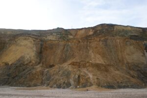
A dramatic view of the cliff directly below where Cliff Farm once stood.
Last year at this time Cliff Farm was on the very edge and the cliff looked very unstable, and by April 2024 the end of the building overhung the edge, and after being in the national news and all over the media the owner finally moved out and the old building, which dates from 1760, was demolished leaving only the footings. Windy Ridge chalet can just be seen left of the telegraph pole and this could suffer the same fate judging by the state of the cliff here.
The rate of erosion at this location is possibly the highest anywhere along the Trimingham shoreline. A combination of ground water through the cliff face and the state of the sea defence here means that any cliff which does fall to the beach is immediately washed away. This is clearly illustrated at the eastern end of the concrete defences where a timber structure was built between the revetment end and up to the cliff base at the time of the original construction and in 2019 this had a gap of 25MTS, in 2023 the gap had increased and now (2025) the gap is around 40MTS!
Take a look at the photograph in the 2019 visit to compare.
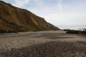
Just east of the end of the concrete revetment and the increasing gap between the cliff base and the sea defence.
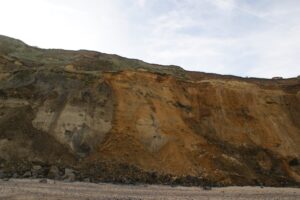
The area below Sea House and here the sea takes away the toe of the cliff and what is unsupported above collapses to the beach.
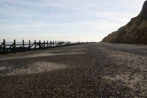
Looking east and the beach below the old RAF site. Originally the wooden revetments were built around 10MTS from the cliff base!
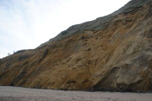
The cliff falling here has taken away a sandy ridge half way up which last year was home to a colony of nesting sand martins. They will have to make new nesting burrows when they return this year.
Looking at the top of the cliff here and the fencing to the old RAF site has a few more of the post slipping over the edge.
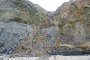
The fresh water spring continues to flow below Beacon Road, but this year it has divided in to two streams flowing on to the beach.
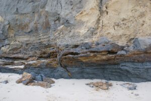
A little further east from the spring and the ancient forest bed remains exposed, one of the many contorted layers caused by the glaciers that created Beacon Hill during the ice ages. This feature remains exposed most of the time now, where as previously it was only visible after storm conditions had washed at the cliff base.
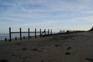
A little further east and most of the timber revetment has now gone and what is there provides no protection to the cliff. The high sandy beach is quite unusual for this time of the year and this continues through to the beach access at the Vale Road gangway.

The Gap at the Vale Road gangway and a high built up beach. There also continues to be quite a lot of flint stones making up the beach here.
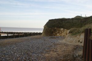
Marl Point at the Vale Road gangway and this is the end of the Trimingham beach, although technically this is on Gimingham beach as the parish boundary is 200 MTS to the west at Trimingham House caravan park.
Marl point is part of the chalk deposit laid down here during the Cretaceous period between 145 and 65 million years ago. Formed from tiny calcite shells from planktonic organisms they settled to the sea bed at the rate of 20mm every 1000 years! The same chalk deposit can be found in mainland Europe in Germany and in geological terms this is referred to as the Masstrictian deposit. The once flat sea bed has become contorted and raised and in some places is rafted over other deposits. A good example of this can be seen at Sidestrand with layers of the chalk folding high in the cliff. The clay, sand and gravel layers were all deposited here during the ice ages.
There is a chalk reef running most of the length of Trimingham beach but it is rarely visible now. At one time it was exposed on extreme low tides and it was possible walk out to, like on West Runton beach today.