TRIMINGHAM
Then and Now
by Geoff Pardon
Following a recent conversation I had regarding my collection of old views of the village, it was mentioned that it would be interesting to visit the locations where the originals were taken and then compare the changes that have occurred over the years, and this is the result. In the descriptions given I have drawn from my knowledge of having lived in the village all my life and my father and my grandfather before me.

TRIMINGHAM DAIRY
A photo taken around 1900 in Church street, Cromer.
This is the middle shop of three that were all owned by T. F. Buxton e sq, along with apartments above.
- F. Buxton was lord of the estate which also owned the tenant farms in and around Trimingham village and the shop provided an outlet for produce from the these farms, and in The Whites Directory of 1898 the dairy is listed as having the finest fresh meat, poultry and dairy for sale with the apartments above available for holiday rent.
One of my aunts, who lives in Cromer, can recall collecting milk in a quart container (2pints) from the dairy before ww2 and they used an entrance down the ally way at the back of the shop.
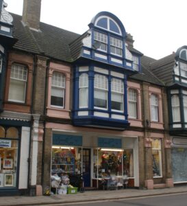
The same shops in Cromer, Church street today 2024
The date when the Trimingham Dairy opened was not recorded but it ceased trading in 1946, at the same time as many of the tenant farms were being sold off. The shops and apartments were also sold and they have remained largely unchanged to this day. The side doorway to the right of the old dairy is now a display window.
The shops have had a variety of different retail occupants over the years and currently the old dairy shop is the Strand charity shop supporting the Sidestrand School. The shop to the left is The Norfolk Gallery and the shop on the right, recently closed, was an interior lighting shop.
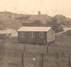
WINDY RIDGE 1922
An old postcard posted in 1922. The wooden structure was originally built by the military at the start of the 1914-18 war and was used in connection with the detection of Zeppelin airships. The airships had been using the cliff-line as a means of navigation whilst on bombing raids along the east coast, and Beacon Hill was ideal position for detecting them.
Following the end of hostilities, and the village became popular as a holiday resort, and the railway companies advertised this part of the coast as a destination to enjoy the golden sands, champagne sea airs and sylvan views with direct rail links from most cities. No longer needed by the military the chalet became privately owned and became called The Ark. It was used to sell teas and ice-creams to the visitors. The road past the chalet at the time led to the main beach access.
For the remainder of the 20th c the chalet became the Windy Ridge and was holiday accommodation.
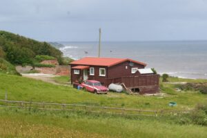
Windy Ridge 2024
The Windy Ridge chalet in 2024, and until recently was the home of a retired army veteran. The view has changed dramatically from the last century and the chalet is the only building remaining due to cliff erosion. The red brickwork in the background are the remains of Primrose Barn, once part of Cliff Farm. Cliff Farm was demolished earlier this year after the foundations overhung the cliff edge following further cliff falls.
The chalet remains the same size as when built but over the years has had new windows and a new door with a canopy. On the other side the original entrance opens onto timber decking with a spectacular sea view. The old felt on the roof has been replaced with corrugated tin.

CLIFF FARM 1937
A post card posted in 1937 with a message saying, “This is where we are staying and we are only 15 minutes from the beach!” Cliff Farm, which dates from 1760, once worked the fields around Beacon Hill and along the cliff top and it became a holiday let from the early part of the 20th century. Behind the fence on the left there was a large outbuilding which was called Primrose Barn. The caption on the card reads `The road to the shore`, and the track led to a junction with the Promenade Lane from the Crown & Anchor hotel and on to Low Street and to the beach access. There were also other cottages and some lime kilns here. The lime was created by heating limestone chalk rock to high temperature and completely drying it out. It was then known as “quick lime” and had various uses including soil treatment, making lime mortar and a lime wash for waterproofing walls.
Not long after the start of WW2 the infamous mine field was sown to protect the RAF radar site, and this led to the cottages being demolished and the beach access being closed. Mines were sown along the entire length of the Trimingham cliff top along with barbed wire and warning signs.
Cliff Farm continued as a holiday let and materials salvaged from the demolished cottages were used to build a house on Gimingham road called Retreat.
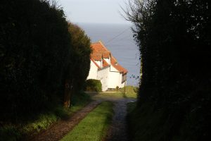
CLIFF FARM 2023
The same view in 2023 and the farmhouse remains, although there have been a few alterations. It has a glass-fronted extension overlooking the sea and there are now two dormer windows facing east. There are also dormer windows facing west; these were not in the original farm house. Primrose Barn and outbuildings have been replaced with garages, and the lane, once the road to the shore, is now a private driveway for Cliff Farm and the Windy Ridge chalet. The lane ceased to be public shortly after the Crown & Anchor hotel fire in 1988, the Promenade lane becoming incorporated into the grounds of Cliff House at around the same time.
Through the 1950s, 60s and 70s Cliff Farm continued as a holiday let and as a youngster I accompanied my mother who used to clean and do the Saturday turn rounds for the then owner, a lady who I only knew as Dolly.
The interior of the house was very original, with lime-wash walls and black-stained woodwork and plank doors with exposed beams and bare creaky floor-boards. Also the original coal-fired cooking range was still in use in the kitchen. Outside there were at least 50 meters of rough grass to the cliff edge and looking at the 2023 photo there now appears to be less than 10 meters! In the early 1980s Cliff Farm came up for sale with an asking price of £6000 and was advertised as having “unrivalled sea views”!
CLIFF FARM UPDATE 2025
At the end of March 2024, following a series of cliff falls due to heavy rainfall over winter, the old farmhouse was left overhanging the cliff edge and with dramatic drone footage the situation gained national headlines. The owner evacuated the building and was assisted by the N. N. D. C Coast-wise team. He had bought the farmhouse in 2019 as a retirement property and thought it to be safe for several years.
To prevent the building falling to the beach the only option was demolition and in May 2024, a team led by N. N. D. C dismantled the building and the site was cleared. On the day of the demolition there was intense media activity with a number of drones filming overhead and around 30 cars parked in the old Crown & Anchor site nearby. A fenced off area at the end of the lane kept photographers and reporters away from the demolition area. All of the national newspapers featured the demolition and it also made the national headlines on TV.
All that now remains of the old farmhouse today are the floors, and nearby the walls of Primrose barn, once part of Cliff Farm. The site is now owned by N. N. D. C. Cliff Farm was the last building on Low Street, an area which at one time had several cottages, lime kilns and a row of terraced houses similar to Malvern Terrace in Middle Street, and all have now been claimed by cliff erosion.

THE OLD STATION 1963
The derelict railway station photographed in 1963, having been left untouched for ten years. The last train passed through on 6th April 1953 when the branch line was closed. Passenger and freight travel was moving away from railways to roads and the rail company, now British Rail, were closing many branch lines. This photo was taken from the top of the stairway off the Hall Road bridge which was the main pedestrian access to the station. When the line was closed it was greatly missed by many villagers. It was a commuter train for workers to Cromer, North Walsham, Norwich and further afield, and the freight service was missed by the local fishermen who had sent their catches to the Great Yarmouth fish market, and George Clark, the village fishmonger, had to find a new way to get his supplies delivered. This had gained the service the title of `The Crab and Winkle’ line. The local farms had also used the freight service to send livestock to market and at harvest time sugar-beet was taken by rail to the Cantley sugar factory.
When I was a youngster the derelict station became a favourite playground and it was possible to enter the station buildings and also a maintenance workshop under the bridge arches at the end of the platform. This was later discovered to be occupied by an old tramp! At one time the enamel station signs, platform gas lamps and fire buckets were still in place. An original station lamp can be seen on the wall of Old Station House on Cromer road.
In the middle distance in the photo the area called Stone Field can be seen and this is now the site of Trimingham Hall.

VIEW FROM THE BRIDGE 2023
In the mid 1960s the station building had been demolished and the site was sold by British Rail and ear-marked for housing development. In 1968/9 builders C. S. Grey Ltd from Mundesley had created Staden Park with 44 new houses, a mixture of chalet bungalows, detached 3-bed houses and semi- detached bungalows. A new access road was also created off the main coast road near to the end of the council houses.
The original rail line travelling east had been a deep cutting with three road bridges numbered 337, 338, and 339. In the late 1960s this became a council refuse tip and locally became known as “The Dump” and it took until the mid 1980s to fill the cutting to the level of the surrounding fields. Now covered with top soil the old rail line has been returned to agricultural use and the bridges appear abandoned in the middle of the fields. One carries a footpath, one carries Middle Street and the old station bridge carries the Southrepps road. The area nearest to Hall Farm is now covered with an array of solar panels generating electricity for the potato storage barns at the farm.
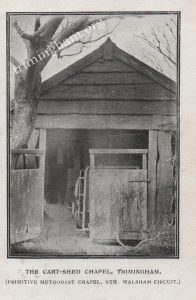
THE CART- SHED CHAPEL
A printed postcard of the Cart-shed Chapel posted in 1907
The Chapel was situated on Middle Street in the garden of Three-ways cottage and in the early 1900s it became the meeting place for members of the Primitive Methodists movement on the North Walsham circuit. Prior to using this cart-shed the services had been held in the open air for around 40 years in the gardens of a clifftop cottage.
The Methodist movement continued to grow and in May 1909 the foundation stones were laid for a new chapel across the street on the site of what was once an old wood yard. Regular meetings and services were held there up until the 1950s. Also the Salvation Army made use of the chapel and they ran first aid classes. It was in addition at one time used by the village youth club.

CART-SHED CHAPEL 2023
The original cart-shed was a wooden structure built onto the end of a brick and stone building and the wooden part was replaced by the Methodists along with extending the other end by about six feet shortly before they moved to their new chapel. Three-Ways cottage had been a holiday retreat for most of the 20th century and in the 1950s the house and gardens were maintained by Mr & Mrs Seago who lived across the street. They kept the property ready for the owners, the Brothel-Bank Fowlers from Leicester. In around 1960 the maintenance of the property was taken on by my father, and mother looked after inside the cottage. The property passed to Marjory Fowler and through the 1960s, 70s and 80s the cottage was in use for around two months in the summer and also at Christmas. Miss Fowler and her visitors were keen swimmers and they travelled to Overstrand to swim in the sea there as we still had the mine-field here. I can recall parties being held in the garden and the old cart-shed chapel being used as a dormitory with several old-fashioned iron beds in it.
In 1990 Three-Ways cottage came into the ownership of my sister and has now been fully refurbished. The Old Chapel has retained much of its original character, with bare floorboards and black-stained woodwork. An original stable-type door remains on the dividing interior wall. Across the street the Methodist Chapel has been turned into two semi- detached properties, an extension being added to the back of the building in the mid 1970s, which made it into the two properties we see today. I only remember the chapel as being houses and the Methodist meetings had stopped by the mid 1950s.
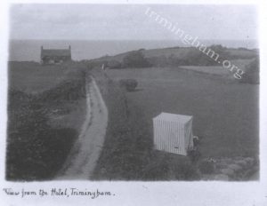
TAYLOR’S LANE
A postcard dated 1906
A photo taken from a window at the rear of the Crown & Anchor hotel looking down Taylor’s Lane towards the sea. The cottage was occupied until the mid 1950s and was just landside of the mine field that stretched along the cliff top from 1940 until 1966 when the beach and cliffs were declared safe. The Rumsby family were the last to live there.
The fields each side of the lane were popular with campers, the one on the left being owned by Beacon Farm and the one on the right was part of the hotel grounds. Just over the hedge from where the person stands in the hotel grounds was the site of a midden (a small refuse tip) and to the left of the lane, opposite the striped tent, was a small pond. This formed part of the natural land-drainage and was linked to a larger pond in the farmyard at Beacon Farm and via a drain pipe under the main road to an area called The Pit at the bottom of Middle Street. The water continued down the side of the lane in a ditch under the hedge and over the cliff beyond the cottage.
Before the mine-field the lane led to a beach access. This was one of several that were created over the years and was simply a track with steps dug where needed and it had to be renewed whenever there was a cliff fall or erosion. This stopped when the mines were sown.
The cliff edge is now approximately between the small bush on the hotel lawn and the tent!
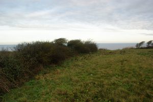
THE SAME VIEW 2024
This photo has been taken as near as possible to the 1906 view. The Crown & Anchor Hotel was damaged by a fire in 1988 and demolished in 1994. At the same time the hedge to Taylor’s Lane was cleared away and only the boundary hedge to Beacon Farm remains today.
Taylor’s Lane came back into used after the mine-field had been cleared and a new beach access was created down the cliff off the lane. It became popular with many villagers and also visitors at the hotel. In around 1970 I had a part-time job at the hotel and one of my jobs was to maintain the gardens, the lane and the footpath down the cliff. It was always the last 50 ft of path onto the beach that required the most work as there was no sea defence then and the sea kept washing it away, mostly during the winter months. By 1974 I had left the job at the hotel but the lane and beach access continued to be popular and was well used until the mid 1980s when increasing amounts of surface water were making the cliff path unusable. Cliff erosion here has increased over the last three decades and by the mid 1990s the cliff edge had reached the site of the old midden. As the cliff edge crumbled away lots of old bottles and jars were exposed and I have a few local brewery bottles and some stone ginger beer bottles from here. Access to the beach is now from Vale Road at the very east of the village.
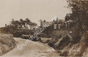
Railway Cottages 1925
The railway cottages on Cromer road. These were built when the railway came through the village in 1906 and were accommodation for the station master and staff. The railway was a joint venture between the Midland & Great Northern and Great Eastern rail companies and was an attempt to capitalise on the East Anglian coastal area as a holiday destination. The line was called the Norfolk & Suffolk joint railway and also included a section of line between Great Yarmouth and Lowestoft, which opened in 1903. The Norfolk section ran from the M & G N station at North Walsham through Antingham, Paston & Knapton, Mundesley, Trimingham, Sidestrand Halt, Overstrand and to the G E R Cromer Beach station.
The station at Trimingham was an island platform with a signal box at the Overstrand end and a passing loop on either side. Access to the platform was via steps down from the double arched bridge on the Southrepps road. The passing loop joined into a single track on the Mundesley side of the bridge.
Sadly the passenger numbers did not materialise and by 1922 economies were made by removing the signal box, the passing loop and the booking office. The station now had a through line and tablet controlled ground frames, to operate the signals and junctions, from the Cromer end, and tickets were obtained from a conductor guard on board the train.
In the inter war years the railways enjoyed the monopoly of passenger travel and freight but following the 1939/45 war this began to drift away to other forms of transport and by the early 1950s the rail company, now British Rail, began making further economies by withdrawing passenger and freight services on many branch lines and on Easter Monday 6th April 1953 the last train service passed through Trimingham.

The Railway Cottages 2023
Both are now private houses and the area behind them, where the station once stood, is now the housing estate called Staden Park built in the late 1960s and early 1970s. The deep cutting on the Mundesley side of the bridge was a land-fill site through the 1970s and is now part of the adjacent fields and returned to farm land. Directly opposite the cottages is another housing development on former farm land. These houses, built in the 1990s, are larger 4/5 bed properties. This development also included a playing field for the use of the village, but with resulting access problems this has been returned to farm land and a new parcel of land has been gifted to the village by Harrisons of Hall farm. This piece of land was once part of the old rail line to the west of the village and backs onto the new village hall site at Stone Field.
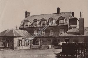
The Crown & Anchor Hotel 1925
Built in 1840s the first licensee was a Mr Thomas Hall, who was also listed in the census as being a wheelwright and a pump maker. The Crown & Anchor Hotel, originally built as a coaching inn, was aimed at the increasing numbers of visitors now venturing to the Norfolk coast to sample the “Champagne sea air” and “sylvan views” found here. It had 18 double rooms and 3 bars. A public-bar, a lounge bar and a cocktail bar in the large restaurant. There were also stables and garages adjacent to the hotel and there was also a road called The Promenade, which led to a beach access near to Cliff Farm.
The pub enjoyed great popularity among both locals and visitors and, like in any community, was a great social hub before TVs and many other entertainments were common place.
At the rear of the hotel there were gardens with a tennis court and lawns. Beyond this there were cliff top grazing pastures belonging to Beacon Farm.
In the early 1970s I worked part-time at the hotel and when I was old enough I served behind the bar. Also one of my tasks was to maintain the track leading down to the beach. This was now at the end of Taylor’s Lane to the left of the hotel, it remained good at the top part of the cliff for several years, but new steps were needed at the bottom onto the beach each summer season.
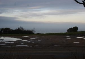
The Crown & Anchor site 2023
The Crown & Anchor continued to be part of the village community until 1988 when during an extensive refurbishment it was damaged by fire. The roof and top floor were gutted by the fire and at first the building was planned to be rebuilt, but after a survey it was deemed unsafe, and in 1994 the remaining structure was demolished, along with the stables.
The site was the subject of a number of proposed developments including a new hotel and also a care home. With the now closer cliff edge any development was increasingly unlikely. Finally the site was purchased by Harrison’s of Hall farm and given over to amenity land. It is now mainly used for car parking and has good access to view the sea. The Promenade road was closed off at the same time and incorporated into the grounds of Cliff House and the cliff edge has now reached to where the old hotel gardens used to be. Taylor’s Lane no longer exists as the hedging was removed when the site was cleared.
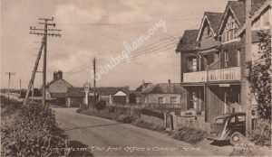
The Post-Office and Coast Road 1959
The Post-Office, seen here on the right, was in no fewer than 9 locations through out its life in the village, and at this time the post mistress was a Mrs Watts, and in the 1920s it was in the property next door, Cubbit’s Stores, and this was run by Polly Cubbit.
On the left, in the distance the “new” road can be seen. Only a few years earlier the Loop road became unsafe for traffic due to cliff erosion and this new section rejoins the coast road on the bend opposite the Church.
In the centre of the photo a picket fence encloses the garden to the house on the left and in the early 1970s this area was made part of the pub car park. This was due to the popularity of the pub with live music and other functions and more people owning cars. On the far side of the car park there are the garages and the hotel restaurant and behind these is Beacon Farm, still a working farm at the time.
The stop for Eastern Counties buses was at he end of the garages and also for the school bus, these were operated by the Green & Gray Coach Company.

Coast Road 2023
There is no post-office in the village now and both houses are now private homes. The restaurant went when the Crown & Anchor was demolished. The garages were demolished earlier than the pub after they suffered storm damage and the roof had collapsed in the late 1970s.
Along each side of the “new” road there is now housing, the chalet bungalows on the land side were built in the late 1960s, including Broadwood Close, and the larger properties on the seaward side were built in the 1980s and 90s. The three bungalows this side of Greystones were all built by Trimingham builder Mr Alan Self, unique in the fact, that at the time Mr Self only had a bicycle for transport and he could regularly be seen going to work with ladders or lengths of timber strapped to his bike. Mr Self did eventually pass his driving test and he then had a Peugeot pick-up truck.
Beacon Farm is no longer a working farm and from the late 1960s it has had a number of uses, including a smallholding, motor workshops and a B&B. The motor workshops were involved with Mini racing, and I can remember a number of complaints about noise with engines being revved late at night as they were prepared for racing the next day. The bus stop has been relocated on safety grounds and is now at The Green, and school children now use the Eastern Counties buses.
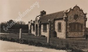
The Pilgrim’s Shelter
A Pearson’s Series photo postcard sold from their tea rooms and general stores, which were in Church Street. The photo was taken shortly after it was built in 1935 by the Reverend Page. It was built as a reading room and meeting place for the residents of the village and was left to the village when he died. Reverend Page also built Pilgrim’s Rest, Pilgrims house and Pilgrim’s Cottage, all in a similar style. The reverend Page was rector in the village from 1909 to 1923. Prior to the Pilgrim’s Shelter all village functions were held at Buxton Hall, the former school, in Church Street.
The Pilgrim’s Shelter is a small building but was used by the village for many functions, including council meetings, jumble sales, fetes, bowls club, parties and many other gatherings. I can recall attending the Sunday school there and also the youth club. I can remember the vicars wife, Mrs Cawte, keeping an eye on us so as to not spill anything on the billiards table!, which took up the majority of the room. The building was surrounded by lawns and when a fete was held the stalls were set up around the outside and car parking was on the field behind the Shelter, with the land owners permission. The billiard table was dismantled and put into storage. When the Trimingham Festivals were held in the 1970s and 80s the land behind the Shelter was not available and the meadows behind the church were used for stall, stands and car parking.
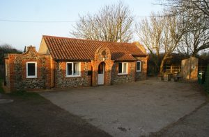
The Pilgrim’s Shelter 2023
The Shelter still functions as a meeting place and has recently been refurbished with new kitchen facilities, furnishings and decorating. Also in 2018 the site was chosen for a Deep History information point, one of 11 around the Norfolk coast. Oak monoliths, seating and information boards tell of the pre-historic world that once existed here!
For many years the Shelter proved inadequate for the purpose of a village hall with a maximum capacity for only 25 people. A new hall was proposed in the mid 2000s and by 2013 a New Hall Management Committee was formed and funding support became available from a number of sources, including Big Lottery Fund, Sheringham Shoal wind farm, N N D C, Geoffrey Watling Charity, DEFRA and fund raising efforts in the village.
By 2015 a suitable site was purchased, Stone Field on Cromer road, and in 2016 building work began and in April 2018 the new hall was completed and officially opened by Norman Lamb our local MP. It was named Trimingham Hall and had a final cost of £750,000 with the majority of funding coming from the Big Lottery Fund, and around £50,000 had been raised by villagers. The village now has two halls and both are well supported. Will the Pilgrim`s Shelter reach 100 years in 2035 or will it be claimed by the eroding cliffs and sea?

Beacon Hill 1930
A colour postcard published by Pearson’s stores of Trimingham. The B1159 coast road winds its way over Beacon Hill and each side of the road is grazing farm land. The small side road on the left is the entrance to The Nest, which was originally a holiday retreat built by the Jarrold family (of the Jarrold department stores). The building on the hill-top is Beacon Hill Cottage which was demolished when the “Golf Ball” radar was installed by the RAF. Directly opposite to this house there was a track leading to the cliff top, which continued on to a beach access at Marl Point below Beacon Lane. Later, due to cliff erosion, the track went on down the cliffs behind where Trimingham House caravan site now is and on to the Fishermen’s gangway. This was the route taken by the fishermen of the village to where the boats were kept, and they had small huts and bell tents on the cliff to keep their gear in.
In 1941 ten acres of land on both sides of the coast road at Beacon Hill was taken over by the M.O.D and was initially used by the army as an early radar site for detecting E-boats and low-flying aircraft as part of the wartime defences. Also at this time the infamous mine fields were sown along the cliff tops, and in 1942 the site was transferred to the Air Ministry when it became RAF Trimingham. The site was equipped with a Type 54 radar on a 200 foot tower, which was sited directly behind Beacon Hill Cottage. On the seaward side of the road three other types of radar were installed on concrete plinths, which remain there today. On the land side of the road a guard-house was built along with access to the underground operation rooms. A military accommodation site was established 1.5 miles away at what is now Fraser Crescent estate and Collingwood Drive. This site also became the base for the mine-clearing operations which took place up until 1966, when the beach and cliffs were declared safe for the public to use.

The same view taken in 2019
Beacon Hill cottage has gone and the track that led to the beach was closed when the M.O.D took over the site. Access to the beach is now via Vale Road. A second entrance to the site has been created just over the hill on the land side of the road. This is for heavy transporters to access the site and move the mobile radar unit contained in the “Golf Ball” to other sites. The sea side of the road was for a few years used as grazing pasture but has now become largely overgrown.
The site was mothballed in 1964 and in 1969 the 200ft tower was demolished; in 1980 RAF Trimingham was closed. The site was sold and the guard-house became a private house. At the end of the 1980s the MOD decided to repurchase the site, but only the landward side of the road. The guard-house was modified, having its original 1940s veranda removed and dormer windows put in the roof. Further development of the site saw Beacon Hill Cottage demolished and by the mid 1990s the radar dome appeared and on-site generators were installed. Today the site remains operational and is linked with RAF Boulmer, in Northumberland and RAF Scampton in Lincolnshire, forming part of the UK air defences.
On the seaward side, cliff erosion has reached the boundary fence of the site, where there used to be around 30 meters of rough grass land and barbed wire fencing before the cliff edge. The entire cliff top had barbed wire fencing which stretched from the Low grounds at Watch Tower Lane on the West side of the village to the border of Mundesley in the East. The fencing had signs warning of mines and to keep out. When the beach was re-opened the wire and signs remained as it was estimated that around 100 unexploded mines remained. Cliff erosion has now taken all of the fencing and the mines!
For more details about the RAF at Trimingham visit:
Wikipedia, RAF Trimingham; Norfolk Heritage Explorer, RAF Trimingham; Subterranea Britannia.
GOLF BALL, M. O. D. UPDATE 2025
In mid 2022 the M. O. D. announced that the “Golf Ball” radome was to be moved from Trimingham to a new inland site within the year. The decision to move was primarily due to the threat of coastal erosion, but military experts were also concerned over interference from the increasing numbers of windfarms offshore, with the turbines said to be creating unmanageable “clutter” on operators screens.
In October 2022 a new radome was under construction 8 miles away at RAF Neatishead and this was due for operation by the end of 2022. Trimingham saw the dismantling of the radome in April 2023 with the site no longer operational, however the M. O. D continues to keep the site in a “moth-balled” state with the perimeter security lights on at night and the grass areas cut. The future of the site is unknown as yet but Trimingham has now lost it`s famous “Golf-Ball” landmark which had been a familiar sight since 1981.
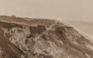
East Cliff 1926
A photo taken looking west from the cliff top behind Beacon Hill in 1926. The large building on the left was High-Cliff House, now High Lawns. The building to the left was the post office and general stores, now Seagulls and Old Post House. To the right can be seen the roof of the large barn at Beacon Farm and in the distance is the Church. The next building in the distance to the right is Bar Haven, a guest house which had a nine-hole golf course, and at the time had its entrance on the old coast road (Loop Road). Bar haven is now Grey-stones and was one of the few properties in the village to have a wartime air-raid shelter. The whitewashed building is Cliff Farm and at the time was a working farm with several outbuildings.
All of the buildings and land to the right of Cliff Farm have been lost to cliff erosion. Some of the houses were demolished and materials used to construct the Retreat on Gimingham Road. Also parts of the red brick and flint walls can be found on the beach after rough weather washes away the beach sand. The area was known as Low Street and a roadway from here led up to the Crown & Anchor yard where it joined the coast road. This road was called the Promenade, and there was another track past Cliff Farm and High-Cliff House which joined the coast road on Beacon Hill.
One of the properties was a four bedroom house called The Lime Works which was owned by a Mr James Marshall. He operated lime kilns here and created a track down the cliff to where the chalk was excavated by hand, employing a horse and cart to bring it up to the kilns for burning. The process produced quick-lime for building and soil treatment. My grandfather, when not at sea, worked for Mr Marshall, and he used to turn the lime in the kilns. This was to ensure the chalk was dried evenly. Mr Marshall was also a saddler and harness-maker.
Low Street used to run further East from here and had a row of terraced houses similar to Malvern Terrace in Middle Street. These were lost to cliff erosion a decade or so before this photo was taken.
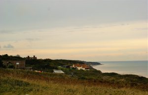
The same view in 2019
This photo was taken from a position as near as possible to the 1926 photo; however, with about 40 meters of cliff top gone, here the view is at a slightly different angle. The cliff edge is now just to the right of Cliff Farm and there are more than 50 meters gone here. The Promenade road has been closed and incorporated into the grounds of Cliff House and the track past High Lawns is now the driveway to Cliff Farm. Cliff Farm is used as a holiday home and the black timber chalet to the left is Windy Ridge, another holiday home. This was once a naval radio listening station operated by WRENS, who were billeted at Cliff House in the 1914-18 war; Cliff House was a convalescent home at the time. High Lawns is now flats, along with the adjoining stables now called The Coach House.
High Lawns, formerly High-Cliff, was once a guest house and gained its name from an extensive lawn area to the west of the building that once had a tennis court and a bowls green used by the guests and the local bowls club.
The bungalow in the foreground is The Dale which was built on the site of a former holiday chalet called The Pightle. This was constructed from an old railway carriage standing on telegraph poles as legs to counter the slope of the land. The farm land in the 1926 photo has mostly all been lost to cliff erosion and the remaining area up to the main coast road is now disused meadow.

Mundesley Road 1930
A view of the Mundesley Road looking East on a printed postcard published by S.E.Pearson, General Stores, Trimingham. The coast road has no markings and no speed limit. The building in the distance is High-Cliff House with its stables, and the next building is Seagulls with the Post Office and general stores just behind the Crown & Anchor hotel sign. Directly opposite here was the fresh-water pump in a gap in the hedge. Not every property had mains water at the time and fresh water was collected and carried to individual properties. There was a cast-iron hand-pump to fill your bucket and a wooden picket fence around the gap in the hedge. Mains water arrived in the 1950s and the derelict pump was removed in the late 1970s and donated to Cromer Museum. The Post Office was also the telegraph station and at this time few houses had telephones, so messages came to the telegraph station where a hand-written note was given to a runner who then delivered it. The runner was usually a young lad and my father used to do this for 6d (2.5p) per message.
The Crown & Anchor hotel was built in 1840s, and had 18 double rooms, two bars and a restaurant. There was also a stable block with hay-loft adjacent to the hotel and this was on the Promenade road leading down to Cliff Farm and the cottages in the area known as Low Street.
The building at right angles to the road pre-dates the hotel and was a converted farm building and was used as a garage and storage by the hotel. Next to this building was Taylors Lane which led almost 120 meters to the cliff edge, where there was a small cottage. On the lane, just past the hotel there was a wide-gated entrance to the hotel gardens, which led to a flight of steps with concrete crowns on plinths at the hotel door. The lawns and gardens went almost halfway down the lane and just beyond here there was a midden. A midden was an early form of rubbish dump and was used mainly for glass bottles, tin cans and ash from coal fires – no plastic or polythene bags in this age. Taylors Lane was a very ancient track and its hedges were composed of sloes bushes, hedge maple, wild filbert nut, crab apple and wild hops. The building behind the flint wall is Beacon Farm, a working farm at the time with pig sties, bullock sheds and a large hay barn around a big square yard behind the farmhouse. In the hedged area just beyond the flint wall was the farm pond. This pond was fed through a drain under the road with water from an area known as The Pit across the main road at the bottom of Middle Street, which was natural drainage from the fields and roadway. The pond overflowed into another drainage pit further down Taylors Lane and this led to a natural drain which ran to the cliff edge at the bottom of the lane.
The white fence on the left was the entrance to a camp site, where the Boys Brigade had a summer camp. The Boys Brigade also camped on the cliff top at Trimingham House, before the District Council created a permanent camp-site on the Gimingham Road.
And in the right-hand corner of the picture is the edge of the Green and the entrance to Middle Street.
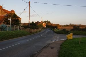
The same view 2019
The coast road looks much the same but now has markings and a 40 mph limit. The biggest change is that the Crown & Anchor has gone. In 1988, whilst undergoing a major refurbishment, a fire broke out in the roof and it was destroyed beyond economic repair, and after standing derelict for five years it was demolished in 1994 along with the stables. The old farm building on Taylors Lane had been demolished in the mid 1970s after the roof collapsed during a gale. The site has now become “amenity land” and is just a grass meadow with sea views. The Promenade road and Taylors Lane have both gone and the cliff edge is now only 40 metres from the main road which would have been up to the lawns and gardens behind the old hotel! The area which was a midden went down the cliff in the 1990s and I have many interesting old bottles and stone jars found from here.
On the opposite side of the road the drainage pit at the bottom of Middle Street has gone, and the surface water now goes into drains connected to the main sewer which was built in the late 1970s.
The pond in Beacon Farm has been filled and the second drainage pit on Taylors Lane has now gone over the cliff. Beacon Farm is now a private house with B&B and no longer a working farm, but in the early 1960s there used to be corn driers in the large barn behind the house and there were pigs and bullocks in the smaller outbuildings. The corn driers were moved to Grange Farm in Church Street when the farm was sold. The fields behind the farm on the cliff edge were used for growing hay and the area which was used as a camp site is now gardens to the Bullock Cottages.

Middle Street 1912
A printed PC dated 1912. The street is a dirt track with no tarmac and this photo was taken just three years after the Methodist chapel was built. The chapel site was once a wood yard with a derelict thatched barn. The Methodists used the small building across the street (the small gable behind the hedge) before having the new chapel built. This was known as the Cart shed chapel and was used for worship from the mid 19th century until the new chapel was built. Before this worship took place in the open air.
The water in the foreground was known as The Pit and was formed by natural drainage from the street and adjoining farmland. Just beyond Malvern Terrace the building at right angles to the street was known as Cubitt’s workshop with double doors opening on to the street. On the left hand side is a farm house which had a small dairy, now Three-ways, and this is one of the older properties in the village dating from before 1750. Directly opposite to the farm was the butcher’s shop.
The Cubitt family had quite a presence in Middle Street – as well as owning the workshop, Samuel Cubitt built two of the cottages at the top of the street and George Cubitt owned Malvern terrace, and he once owned Three-ways before moving to Beacon Farm.
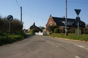
Middle Street 2020
The same view in 2020. The tarmac road now has drainage connected to the mains sewer and The Pit has disappeared with drainage from the farm land going into a ditch behind the bank on the left. The chapel is now two private houses and was used for worship up to the 1950s. Behind the privet hedge in front of the chapel are the remains of a flint wall, which was part of the old thatched barn from the wood yard. Just past the stone wall At Last has been rebuilt with an upper floor. The next property, Little-Dene, once two cottages, has been made into one but remains single storey and The Butchers Shop is now an annex to Little-Dene. Malvern Terrace is virtually unchanged and Cubitt’s workshop is now Berlea cottage. The large doors that once opened onto the street have been bricked up and replaced with two circular leaded windows.
On the other side of the street Three-ways was a holiday home from the around 1910 up until now and was owned by the Fowler family from Leicester until 1990 when it was then purchased by my sister. During what became a major refurbishment much of the original farm house came to light. The original dairy became the kitchen with a trap door leading up into the hay loft, which is now a bedroom. Opening up one of the fire places revealed an old bread oven and many of the original timbers have been preserved throughout the house including old ship’s spars in the roof, which presumably were salvaged from shipwrecks from the local beach. There was once a rumour that a smugglers’ tunnel led to a cellar under the cottage but alas we found no evidence of this.
When the Fowlers owned Three-ways the Cart Shed chapel was turned into an annex with four beds for extra visitors, and in the 1950s and 60s there were a lot of visitors in the summer months. My father used to maintain the house and gardens and I continued this until recently.
Adjacent to the farm house the old barn has been converted into two properties, Blazes and Sou-west.

Church Street 1935
A photographic postcard dated 1935. The view shows the road going to the left at the church and in to Loop road, which at the time was still the main coast road. The road has no white lines and there are no street signs. The row of cottages on the left were owned by the Pearson’s. The first cottage was a grocery and general stores, the middle cottage was holiday accommodation and the cottage nearest was Pearson’s tearooms, catering for visitors and holidaymakers. The M&GN railway brought many visitors to the village and they stayed at the Crown & Anchor hotel and guest houses such as Bar-haven, Cliff-house and Highcliffe. At this time enormous benefits to health were said to be had from a holiday or short stay spent in the dry “champagne” air at Trimingham and after a scramble down the cliffs secluded and safe bathing could be had! (this was before the mine fields).
The grocery and general store also became the post office, but at the time this photo was taken it was at Cubbits stores on Mundesley road, (now the Old Post-house).
On the corner of Church Lane there is a large stone, this is a piece of grey limestone left behind as glacial drift during the last ice age, locally these were known as “mount stones” and used as an aid to mount bicycles and even horses. There used to be another one of these in the old pub yard and the one that is in the photo is still there today, around the corner in Church Lane.
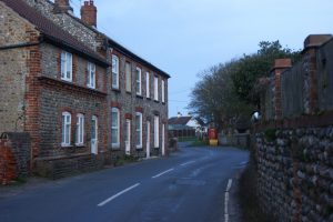
The same view 2020
The main road now takes a sharp right bend and rejoins the original coast road at The Green. The new road was built in the late 1950`s due to cliff erosion and the old road became known as the Loop road. Loop road was not very busy and I remember as a youngster running our home made go-karts from just behind Grey-stones down the hill, around the bend at Bottle-dene and all the way to the shop! It was still used up until the mid 1980`s when the cliff erosion reached the road and motor vehicles were barred and barriers were placed just beyond Grey-stones at the eastern end and Bottle-dene at the western end. The road has now gone behind the new houses and is mostly overgrown and inaccessible. The row of cottages are all now holiday homes and the cottage on the left, (Trimmy house), has had its roof raised. In the mid 1960`s the Post Office moved from Bottle-dene on Loop road to the grocery and general stores and it was run by Alice Pearson. I remember the layout inside the shop, the entrance door had a bell on a springy piece of metal which alerted Alice there was someone in the shop. A beam across the ceiling had rows of pegs from which various items hung for sale, and these included ladies hair nets, sticky fly catching strips and lamp wicks. A glass cabinet behind the door contained various souvenirs including crested china, novelty ash trays and Trimingham-on-sea car stickers. On a shelf behind the counter there were a row of large glass jars containing various sweets, mint humbugs, lemon sherbets, jelly babies etc. To the right of the door beside the newspaper rack there hung a Frith’s postcard rack with sepia postcards all with views of the village. The post office counter was in a small room at the back of the shop and the post box was built into the wall just down the side of the shop off the road.
In the late 1970`s the isolated North Norfolk area suffered a spate of post office raids and Trimingham was one that was targeted on two separate occasions. The first raid resulted in Alice receiving a black eye and broken glasses but nothing was taken and the assailant fled. On the second occasion two masked men broke into the shop and threatened Alice with an iron bar and made off with a four figure sum of cash. Alice, in her mid 70`s, was badly shaken but still opened the shop and post office the following day. Unfortunately this spelt the end of both the shop and post office and not long after the raid they both were closed. The red phone box was installed in the late 1950`s and was used by many villagers, several times I recall having to queue and wait to make a call! The box now houses a defibrillator for emergency use.

Church Street 1934
This is the lower part of Church Street and on the left is the school. Built in 1849 by Lord Buxton for the education of poor children, it was in use as a school until 1932. After this the youngsters of the village attended the Belfry School in Overstrand. Following the closure of the school the Rev. Arthur Buxton allowed the building to be used as the village hall and functions such as Christmas parties, jumble sales, dances and whist drives were regularly held until this all moved to the Pilgrim Shelter.
Further along the street is Grange Cottage. This used to be where W. Warne ran a blacksmith shop, and on the other side of the street there are eight semi-detached flint cottages, all built by Lord Buxton. George Clark, a fisherman, lived at number 16 and he had a smoke house at the back of the cottage. He worked his boat, Mayflower, from Trimingham beach until the mine field stopped all fishing activity. After the war the beaches remained closed but George used the railway to bring fresh fish and crabs from along the coast to Trimingham where he then delivered them around the local villages. This gained the railway the title of The Crab & Winkle Line.

Lower Church Street 2020
Buxton Hall, the old school, is a private property now but in the 1980s and 90s Norman Spence ran a motor repair shop here and both myself and my father had our cars fixed and MOT’d here. Norman is now retired and still lives there today.
Most of the cottages are now hidden from view by garden growth and trees but are largely unchanged, apart from the usual modern additions like plastic window frames.
This is the narrowest part of the busy main coast road through the village and it has been on the parish council agenda for decades to get street lighting and/or a footpath past the houses to join the pavement at the church. The most recent development was to extend the 30 mph speed limit to beyond Woodlands Leisure Park. There is still a need for 20 mph through Church Street and the bend at the church.

Loop Road 1955
A photo taken in 1955 showing Bottle-Dene cottage as the post office. The double garage with accommodation above was added by Kidd builders just before this picture was taken. Bottle-Dene gained its name from the bottle shaped chimney at the far end. The cottage on the right was Rotunda cottage and it was one of the oldest properties in the village. Built before the 17th century it was said to be used as a look-out in smuggling days as it was directly overlooking the lane opposite which, at the time, led to the beach access.
This was the main coast road until the early 1950s when the “new” road was constructed from the bend at the church to the Green at Middle street. The Loop Road remained open to traffic but was restricted to light vehicles and access only. The road had very little use and the cliff edge was very close to the road just around the bend near to Bottle-Dene and there were fields still being farmed behind Pilgrims Shelter and at the Middle Street end at Beacon Farm.
By the mid 1970s cliff erosion had reached the road in two places and barriers were placed across the road to stop all traffic using it. A barrier was put up at the end of Bottle-Dene and another just beyond the entrance to Greystones at the eastern end. It was still possible to walk the length of the road at this time. In the late 1980s the road fell away in two places and it was no longer possible to use it at all. Also the land on the clifftop stopped being farmed but was used as horse paddocks for a while.

Loop Road 2021
Same view 65 year later. Both cottages have gone and so has the road beyond this point. The cottages were recently demolished as part of the “Managed Retreat” scheme where by planning would be given to build away from the erosion area if the properties in danger are demolished.
The post office moved from Bottle-Dene to 20 Church Street where Alice Pearson ran it along with tea rooms and a grocery store up until 1980. The cottages were occupied until around the mid 1990s and when they became vacant a barrier was placed across the road just past the Pilgrims Shelter entrance. This has only recently been removed after the cottages were demolished and it is now possible to walk to the cliff edge at the end of the road in this photo. It is also still possible to walk as far as the barrier at the eastern end which remains just past the entrance to Greystones.

Fisherman’s Gangway around 1910
Being a coastal village there has always been fishing activity here at Trimingham and this photo, taken in around1910, shows the beach access at the very eastern end of the village. On the cliff top in the far distance the church tower at the Garden of Sleep at Sidestrand can be seen. This toppled over the cliff in 1916.
The gangway is a simple dirt track leading to the beach where there are a few tents for people to change in for bathing. The fishermen kept their boats on the open beach and in stormy conditions and at extreme high tides they were man handled up the lower part of the cliff for safety. They also had bell tents and small huts on the cliff to keep their gear in. The boats were loaded on to horse drawn wagons and pulled up the track and to the village for repair and maintenance, this was at Kidd’s yard around Loop road and Cubbit’s workshop in Middle street. The fishermen used to walk from the village to the boats along a footpath from the top of Beacon Hill to a track from behind Beacon Lane and onto the cliff, this can be seen joining the gangway in the photo.
With the coming of the Second World War and the establishment of RAF Trimingham all fishing activity stopped and the land on which the gangway was sited was requisitioned by the MOD. The cliff tops and cliffs were sown with land mines as a defence and no one was allowed to use the beach access. All fishing activity stopped as many of the fishermen were of retirement age, and the younger ones either joined the navy or fished from neighbouring villages. This saw the break-up of the fishing community in the village, along with their way of life.

Fisherman’s Gangway 2021
The same view taken in 2021. The gangway is now known as the Vale Road beach access and it now has a tarmac surface. This was constructed in in the late 1970s as part of the sea defence construction to allow heavy machinery to access the beach. The route of the gangway now runs further west and reaches the beach just past Little Marl Point.
The beach remained closed to the public until 1966 when it was declared safe after the Army Mine Disposal squad spent 20 years searching and clearing the cliffs and beach of mines. The Army Mine Disposal squad were based at RAF Trimingham which is now Collingwood Drive housing estate.
Fishing activity began again in the early 1970s with beach fishing and bank lining for cod with a few small boats launched from the beach below Marl Point. The gangway was still only a sandy track at this time and everything was carried to the boats by hand and they were launched and recovered with skeets and rollers over the sand. Around the mid 1970s there was a boom in crab fishing and full-time fishing began again from Trimingham. It was also at this time the gangway was tarmacked and this enabled tractors to be used for the launch and recovery of the boats. By the late 1970s there were six full-time motor crab boats operating from Marl Point and around twelve part-time boats that were kept on the gangway. These all had small tractors to launch and recover.
Today there is only one full-time fisherman in the village, Andy Pardon, but he now operates from the Mundesley beach. There are no fishing boats kept at the gangway today, but part-time fishermen still launch and recover their boats and fish from Trimingham. The beach access is now used mainly for leisure activity with jet-skis, kayaks and hang-gliding. The roadway and car park are now maintained by the local council.

RAF Trimingham 1955
The RAF presence in Trimingham began in 1938 with the establishment of the radar site on Beacon Hill. With the rapid development of radar in the Second World War a 200ft tower was built on Beacon Hill along with various other radar plinths on the cliff top.
Also underground operation and storage bunkers were constructed under Beacon Hill.
By the 1950s and with the start of the “cold war” Trimingham became part of the UK’s early warning radar network and the RAF presence increased to include the base in the photo and an accommodation site further along the Mundesley road. Also around this time the road was widened from Beacon Hill to Mundesley where there were anti- aircraft guns on the cliff-top behind Trafalgar Court. The military base was also used by the Royal Engineers as a base for their mine clearing operation on the local beaches.
With large numbers of personnel on the base the local pubs and tea rooms were kept busy and the base also had its own football team and they played village teams in the local amateur league.
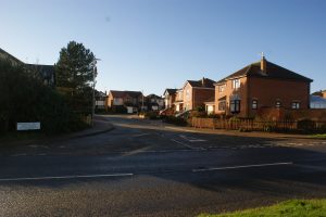
Collingwood Drive 2021
The same view today and the RAF site is now a housing estate. The RAF site remained operational until the late 1960s, and after the Royal Engineers had cleared the local beach of mines, it was mothballed and by 1980 it finally closed.
At the end of the 1980s the Beacon Hill part of RAF Trimingham became operational again and the now familiar “golf-ball” appeared and it is now called RRH (Remote Radar Head) Trimingham, which is linked to RAF Neatishead, and forms part of UK air defences and is operational today.
Development of the Mundesley Road site began on the old accommodation area in the mid 1980s. This became Fraser Crescent leading to Anson Close and in the mid 1990s Collingwood Drive was built on the main base site, leading to Lancaster Rise and Nelson Way. In total more than 200 houses were built on the two sites.
Although called RAF Trimingham the old base was actually in Mundesley and as a memorial to the service men who were killed whilst mine-clearing the local beaches there is a monument on Cliff Green at Mundesley.
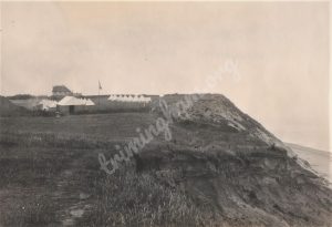
Boys’ Brigade at Trimingham House 1926
In the early part of the 20th century many towns and cities had Boys` Brigade companies and Trimingham was a location where summer camps were held. This photo was taken in 1926 and the tents are pitched in the grounds of Trimingham House on the cliff top. Prior to this the camp was held at Beacon Farm, again on the cliff top, in fields now lost to the sea. After the mid 1930`s the camp moved to the Gimingham road on a site owned by the District Council and this site had a purpose built wooden mess hut and a toilet block.
The camp locations were also used by the military and camped troops, notably “The Bicycle Corps”, would use a firing range sited at the west of the village on an area known as the “Low Grounds” off Watchtower Lane.
The Trimingham House grounds had a short path to the fisherman`s gangway and the Boys Brigade used this to access the beach for swimming.
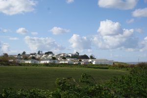
The same view 2022
The location is now THE TRIMINGHAM HOUSE CARAVAN PARK, and there are around 100 permanent holiday caravans on the site. In the 1950`s and 60`s the site was a touring caravan site and the old house became a club house with licensed bar and entertainment. In around 2000 the house was demolished and replaced with a new site office, cafe and an open air swimming pool.
This exposed cliff top location has always been effected by the weather and in the southerly gales of 1987 a number of caravans were blown over the cliff and ended up in pieces on the beach. More recently in 2019 a large landslip saw three caravans hanging over the cliff edge and under the “managed retreat” scheme the site was given planing to extent inland to the edge of the coast road and move all the cliff edge caravans away from danger.
With the Sandy Gulls caravan park also near by the old fishermen’s gangway has become very busy with visitors making use of the unspoilt local beaches during the summer months.
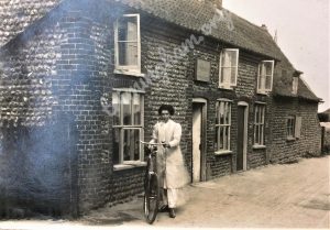
Middle Street 1909
Plumbly’s Grocery store, Middle Street in 1909. Emma Plumbly poses outside the stores. The Plumbly family were recorded in the 1911 census as living at Three-ways directly opposite to the stores. Also next door to here was the Butchers shop and this was run by Mr Fred Plumbly and he was recorded as having lodgings at The Crown & Anchor hotel.
Shortly after this photo was taken the thatched cottage at the far end, “At Last”, was destroyed by fire but eventually rebuilt with a first floor.
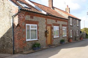
Middle Street 2022
Same view in Middle Street in 2022. No longer a grocery store and when it stopped trading is not recorded but Emma Plumbly was no longer recorded as being a grocer in the 1921 census. The property is now Little Dene and is all one dwelling with the old Butchers shop now an annex to the main house. It has all been fully modernised.
The end cottage, “At Last”, remains unchanged from when it was rebuilt after the fire, this has also been fully modernised.