TRIMINGHAM BEACH revisited 2024
Another series of photos looking at the beach and cliffs along the Trimingham shore. Previous visits were in 2019 and 2023, and this is the situation in Jan 2024. The beaches to the east remain sandy and built up, usually the winter sees lower scored beach levels all along the Norfolk shoreline but over the last few seasons this has not been the case. As most of the winter storms this year have had south and westerly winds they have not combined with moon tides to create any surge. Towards the west of the beach the levels are lowered and this is mainly due to the sweep of the sea along the concrete section of defences. There have also been quite a few cliff falls due to the heavy rain fall experienced before Christmas.

The Gap at the Vale Road gangway with high beaches and a bank of stone, unusual for this time of the year. There are usually about five boards of the revetment showing above the beach level. The steps on the left are completely covered.
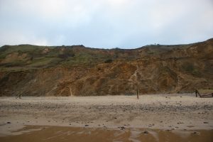
The area below Trimingham House caravan site. All of the cliff fall that occurred here in 2019 has been washed away and the beach has now built up to previous levels, all of the revetment was broken off at beach level by the fall. The cliff top caravans have now been relocated away from the cliff edge. No further cliff falls here but there is still a lot of water seeping through the cliff and making it’s way to the beach.
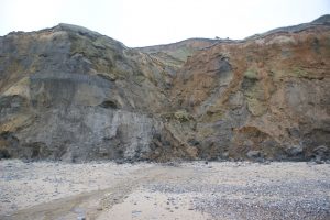
The fresh water spring continues to flow below Beacon Road and the base of the cliff continues to crumble away.
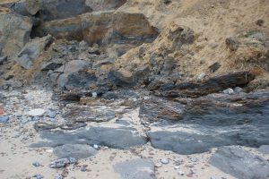
A short distance from the spring a small piece of the Cromer Forrest Bed is exposed at the base of the cliff. This feature can produce fossils, and it was this layer of sediment that produced the almost complete fossil of a steppe mammoth at West Runton in 1994.

A section of the sea defence below Beacon Hill. Around 10 years ago the beach in front of the defences was lowered to a level where by the steel piles were unsupported on the sea side and water pressure built up behind until they burst like a dam wall giving way. There are two fresh-water springs flowing from the cliff in this location. This sandy piece of cliff can clearly be seen crumbling and sliding down to the beach, and at this time of year with the increased rainfall it has been much worse than usual. As the defences continue to deteriorate the high tides get to the cliff base and wash away the fallen material.

The cliff top at the old RAF site. The fence has slipped a little more but the vegetation has held the cliff from falling away.

The cliffs at beach level below the old RAF site at Beacon Hill.

Below Cliff Farm and the piece of sea defence that originally was at the cliff base when the defences were built, it was at 25mts in 2019, and at 40mts in 2023 and now, 2024 a few meters further away and the situation here is the sweep of the high tide gets over and behind the concrete wall and flows west to east along the cliff base and takes away the beach and the foot of the cliff at a much higher rate than any where else along the entire beach. The beach here rarely gets any higher than seen in this photo.

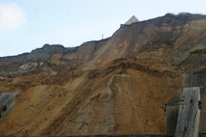
Two views below Cliff Farm and Windy ridge with recent quite large cliff falls. These occurred after the recent heavy rain and the cliff is still crumbling and sliding here and it looks like there could be more to fall!.


Two views of the concrete promenade below the old Crown & Anchor site and the rate at which it is being undermined has really accelerated and in some places it has now dropped by at least a meter.
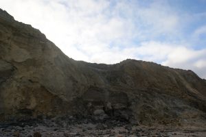
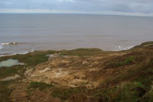
Two more views at the old Crown & Anchor site. The top photo is from beach level and a steady flow of liquid sand and clay is making its way to the beach. The next photo was taken from the top of the cliff and it shows the large amount of surface water now coming from the upper layers of the cliff at this location. A lot of water forming large pools before finding its way to the beach. Surface water has been a major problem in this location over the last few decades.

Behind the concrete wall and the eroding foundations. Every high tide sweeps over the wall and the west to east flow of the tide takes away more and more of the foundation.

Another view behind the defences and the scouring away of the beach and cliff. This area of beach is below Middle Street.

The western end of the defences remain complete and are functioning as designed, the concrete is covered with a sandy beach and the timber revetment is mostly undamaged. There is very little surface water coming from the cliff at this location.

The end of the defences, undermined and distorted but still doing its job. But for how much longer?

Another view at the end of the defences. The sea has now eroded away the cliff to the right and is now able to sweep behind the revetment. Originally the base of the cliff was at the revetment and it was still at that point in 2019. Also in 2019 there was a cliff path that reached on to the beach at this point.
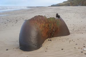
The old marker buoy still sits at the western end of the beach. It’s a little more corroded away but in the same location.